Participatory Coastal Land-Use Management (PCLM)
ABOUT THIS ISSUE
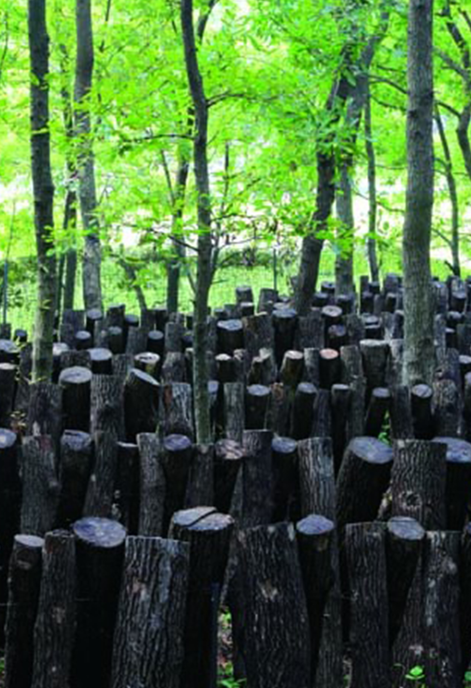
Urbanization often results in the conversion of coastal ecosystems to urban or agricultural lands. If not well planned, this can cause increased exposure to coastal hazards
SOLUTION
The PCLM tool uses participatory approaches and free modeling tools to estimate land-use change impacts and identify countermeasures
Coastal planning in the context of urbanization and climate change
Coastal ecosystems provide many benefits to people. However, these ecosystems are often degraded or converted to other types of land-use during the process of urbanization to meet the growing demands of urban residents for food (i.e., additional land for agriculture or aquaculture) and living space (i.e., additional urban land). This land-use conversion process can lead to unintended social and environmental problems due to the loss of the benefits provided by the coastal ecosystems, e.g., for coastal protection or ensuring abundant fish supply.
To enable more resilient land-use planning in coastal areas and facilitate the incorporation of relevant NbS in planning processes, local governments need to have a general understanding of:
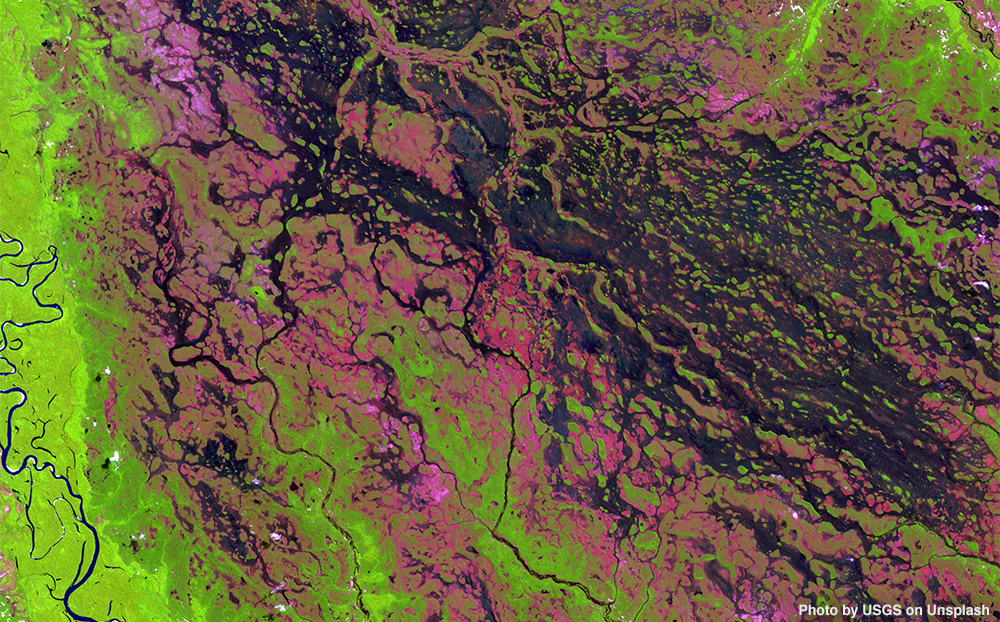
- How the land-use (and climate) are likely to change in the future, e.g., over the next 10, 20, or 50 years, considering different plausible scenarios; and
- The potential impacts of these future changes, e.g., on coastal flooding, sea level rise, and groundwater quality.
PCLM approach for assisting coastal planning
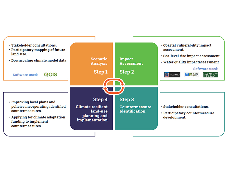
The PCLM approach is intended to help with this process of understanding the impacts of future land-use and climate changes, and in developing suitable countermeasures (including NbS). The PCLM approach utilizes a combination of participatory processes and geospatial modeling techniques for this impact assessment and policy development, and consists of four main steps (Figure 2):
- Scenario development: Future scenarios of land-use change and climate change are generated through participatory mapping and downscaling of climate projections, respectively;
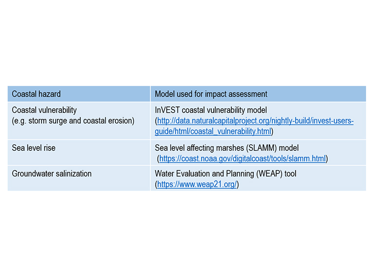
- Impact assessment: Impacts of the future land-use change/climate change scenario(s) are analyzed using different free computer models and software (See Table 1);
- Countermeasure identification: Local governments within the coastal study site identify countermeasures based on the risk assessments, and try to agree upon some priority countermeasures relevant for all local governments in the area (e.g., transboundary NbS or infrastructure measures);
- Climate resilient land-use planning and implementation: Local governments use the identified countermeasures to improve their land-use plans, and for development of climate change adaptation actions and policies. The identified countermeasures can also be used to develop project proposals for domestic or international sources of climate change adaptation funding (e.g., through the Green Climate Fund).
Examples of countermeasures, including NbS, identified using PCLM in Oriental Mindoro, Philippines
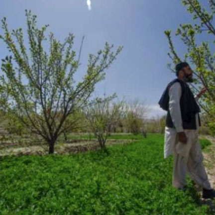
In 2019–2020, Calapan City, a coastal area undergoing urbanization in the Philippines, was used as a case study for the implementation of the PCLM approach. Through the implementation of the project, local government officers were able to identify several relevant countermeasures to reduce the impacts of future land-use and climate changes. Among these countermeasures, most can be considered an NbS, as they are intended to enhance biodiversity conservation while at the same time providing social/economic benefits through hazard reduction and livelihood diversification.
| Proposed adaptation measure | What type(s) of hazards are targeted? | How will the project directly benefit poor communities? | How will the project help conserve key biodiversity? |
|---|---|---|---|
| Strengthen the management system of the existing marine protected areas in Calapan City | Storm surge, sea level rise, coastal erosion | Protection against storm surge, coastal erosion, and sea level rise | Implementing actual protection strategies physically helps conserve the ecosystems of our marine sanctuary, mangrove forests, and coral-seagrass areas |
| Production of educational and information materials for local communities, schools, and commercial establishments on the benefits of marine protected areas and the role of each individual in the protection of these important ecosystems | Coastal erosion, sea level rise, storm surge, flooding, typhoons, and saline water intrusion | Raising public awareness is raising public participation and involvement | Information is education - illegal activities in the protected areas will be minimized if everyone is knowledgeable on the importance of coastal ecosystems |
| Capability Enhancement of the local communities through trainings and planning-workshops | Coastal erosion, sea level rise, storm surge, flooding, typhoons, and saline water intrusion | Knowledge transfer and skills development in conservation and protection | Conservation planning and training will make stakeholders equipped with more knowledge and experience to reduce habitat and species extinction/loss |
| Mangrove tree planting | Coastal erosion, sea level rise, storm surge, flooding, typhoons, and saline water intrusion | Protection against storm surge, coastal erosion, and sea level rise | Ecosystem enrichment through propagation of mangrove species |
| Marine Protected Areas patrolling | Coastal erosion, sea level rise, storm surge, flooding, typhoons, and saline water intrusion | To ensure protection from poachers and illegal fishers | Natural growth if there are no outside disturbances/ pressure |
| Providing alternative livelihood opportunities | Coastal erosion, sea level rise, storm surge, flooding, typhoons, and saline water intrusion | Additional income to the families in coastal areas | Reduced extraction of wood and other materials from coastal ecosystems because of the alternative sources of income |
| Strengthen community organizations responsible for the protection and conservation of the protected areas. | Coastal erosion, sea level rise, storm surge, flooding, typhoons, and saline water intrusion | Community participation will be enhanced | More MPA protection warriors that will encourage more protection efforts from the community |
Tips for users
- The PCLM tool can be used to help identify and plan an NbS for mitigating the future exposure/vulnerability/risks associated with coastal hazards. The countermeasures that can be identified using the PCLM approach can include an NbS as well as other types of measures like training/capacity building and gray infrastructure construction.
- If interested in conducting the PCLM approach, it is recommended to form a team with relevant technical and planning expertise. For example, it is advisable to involve technical staff familiar with Geographic Information Systems (GIS) software, Scenario Analysis, and Impact Assessment. Involving subject experts, e.g., disaster risk reduction, water quality, or biodiversity experts, is also helpful for identifying suitable countermeasures.
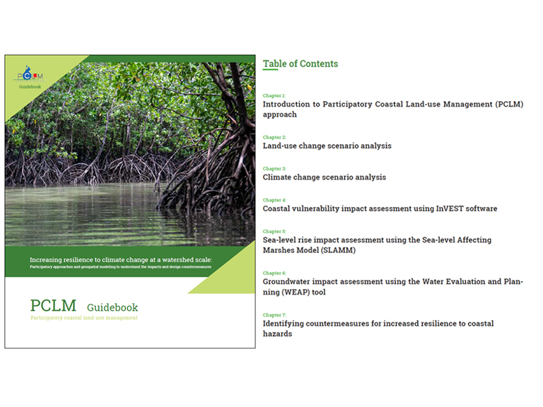
- To provide more information, a training guidebook was developed with instructions and step-by-step tutorials for all of the software and participatory processes needed to conduct PCLM. Additional resources are also available at the respective websites for each software (see Table 1 for links).
Acknowledgement:
We would like to thank all of the local and provincial government officials from the Philippines who participated in on-site/online trainings and helped us to improve the PCLM approach, including the local governments of: Baco, Bansud, Bongabong, Bulalacao, Calapan City, Gloria, Mansalay, Naujan, Pinamalayan, Pola, Puerto Galera, Roxas, San Teodoro, Socorro, and Victoria; and the Oriental Mindoro Provincial Agricultural Office.
References
-
Johnson, B.A., Magcale-Macandog, D. M., Kumar, P., Dasgupta, R., Kawai, M. (2021). Participatory coastal land-use management (PCLM) guidebook: Participatory approaches and geospatial modeling for increased resilience to climate change at the local level. Institute for Global Environmental Strategies.