[NOTICE] The following AP-PLAT tools are temporarily unavailable due to maintenance.
- ClimoCast
- Climate Impact Viewer
User Activities Vol.1 Exploring ClimoCast: A Kyoto University Student’s Perspective

In this first installment of our User Activities series, we introduce real-world use cases and insights from actual users of AP-PLAT tools. Through this series, we hope to encourage more people to explore and utilize scientific tools related to climate change.
Introduction
On December 15, 2025, students from Kyoto University visited NIES to take part in an interview with Dr. Masutomi of AP-PLAT. After returning to their university, one of the students actively used ClimoCast and shared his impressions with us.
Interview
Q: Could you tell us about your experience using ClimoCast?
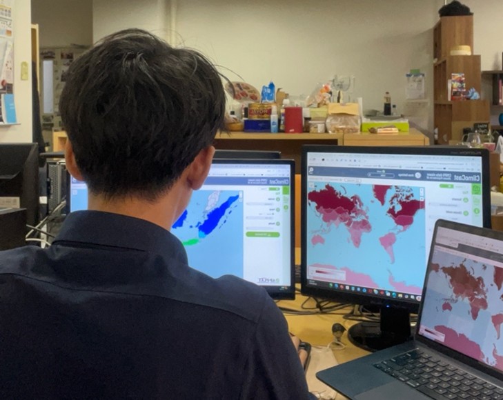
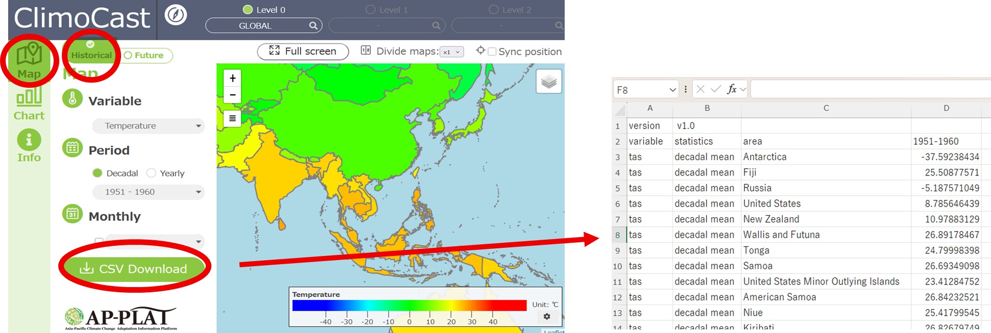
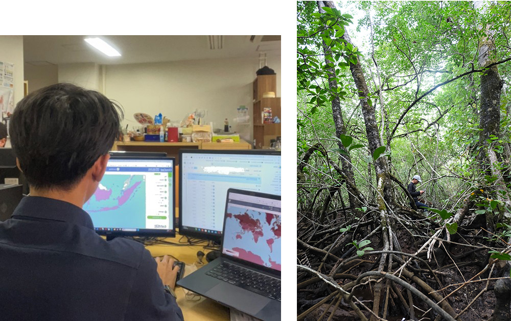
A: I used ClimoCast to explore both future climate projections and historical climate data. The interface is convenient and user-friendly, offering a simple way to understand global-scale data through maps and charts. The availability of data in CSV format is especially helpful, as it allows easy conversion into basic software for further analysis.
I am particularly interested in the types of scenarios and climate models provided, such as SSP126 (Low emissions) and SSP245 (Medium emissions), and would like to learn more about them. Adding more detailed explanations of each climate model and scenario on the “Info” page would further improve usability.
Q: Thank you for your feedback. We currently provide information about climate scenarios on the “EXPLORE ADAPTATION” page, and we are developing a new page with more detailed explanations.
Q: What kind of research are you currently working on?
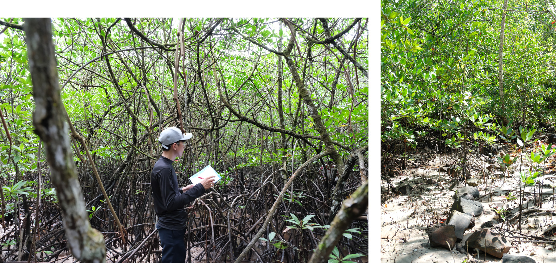
A: I am conducting research on mangrove change analysis and blue carbon storage. Using Geographic Information Systems (GIS), I analyze mangrove distribution and land cover changes to better understand their environmental role.
Q: What types of data are important for your research?
A: Both spatial and tabular data—such as maps and tables—are essential. For pre-analysis, I use administrative boundary data (vector shapefiles), digital elevation models (raster data), and vegetation indices derived from satellite imagery, particularly Sentinel data.
Q: How do you usually collect or analyze climate-related data?
A: For climate-related variables such as sea-level rise and water dynamics, I use a modified Normalized Difference Water Index (NDWI), calculated from multispectral imagery bands.
Q: What did you learn from using the climate prediction tools?
A: I learned how to interpret climate projections using different models. I also realized that there are many projection models currently being developed to understand future climate conditions, which are clearly presented in ClimoCast through its climate models and scenarios.
Q: Do you think these tools can be applied to your research?
A: Yes, these tools can be applied to my research, particularly for analyzing temperature changes and precipitation history. They help identify areas experiencing significant climate change. However, since my research focuses on a detailed spatial scale—one district and five sub-districts—higher-resolution data would be beneficial.
Q: Yes, that is correct. We are currently working on improving the statistical downscaling process, and will continue to enhance ClimoCast to further improve its usability.
A: Additionally, these datasets are valuable for my research team, which studies people’s adaptability to climate change in East Asia. ClimoCast and the Climate Impact Viewer help identify areas vulnerable to high temperatures and heavy precipitation, which are closely linked to future disaster risks.
Q: What kinds of features or spatial scales would be useful in the future?
A: Higher-resolution climate models would be particularly useful for climate adaptation and disaster prevention efforts, as they allow more precise detection of climate impacts.
Q: How do you hope your research will contribute to society or your local community?
A: My research contributes to identifying and assessing how mangroves support Nationally Determined Contribution (NDC) goals. Mangroves are important assets for preventing carbon reserve loss and mitigating temperature increases.
Conclusion and Further Resources
Research has shown that mangrove forests play important roles in both climate change adaptation and mitigation. AP-PLAT features case studies from around the world, and NIES and A-PLAT also provide related information that may be useful.
- AP-PLAT: Establishing Mangrove Belt to Combat Coastal Flooding in Indonesia
- AP-PLAT: Coastal Mangroves for Livelihood in Sundarbans, Bangladesh
- AP-PLAT: Puerto Galera Mangrove Conservation and Ecotourism Area in the Philippines Protects the Coastlines and Stimulates the Local Economy
- AP-PLAT: Climate Change Impact Assessment of Storm Surges and Storm Waves on Pacific Islands
- A-PLAT: Conservation and Restoration of Mangrove Forests (Japanese website)
- A-PLAT: Climate Adaptation Q&A – Mangrove Forests (Japanese website)
- NIES: Tropical Coastal Ecosystems Portal (TroCEP)
Interviewing the students brought new insights and perspectives to AP-PLAT, and we were encouraged by their thoughtful and critical use of our tools. It is especially rewarding to see our tools being used by the younger generation, who will shape the future of climate change adaptation research.
(Posted : 02/Mar/2026)
