Challenge
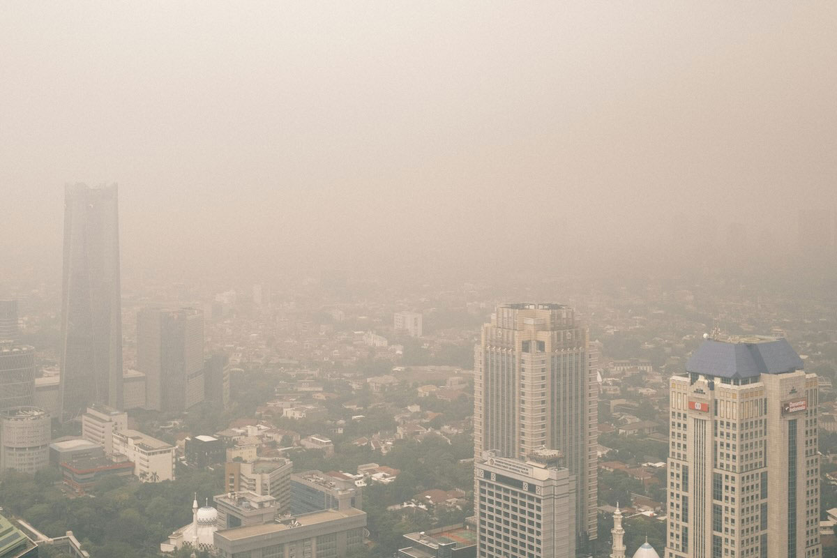
Southeast Asia faces recurring haze and poor air quality from biomass burning and industrial activity.
Solution
Quantify emissions, analyze long-term pollution trends, and link regional transport to surface ozone and particulate matter.
Overview
Haze episodes and poor air quality affect millions across Southeast Asia during dry seasons and biomass‑burning periods.
An Asia‑Pacific Network for Global Change Research (APN) project led by Justin Sentian (Universiti Malaysia Sabah, Malaysia) investigated how climate variability, open burning, and biogenic and industrial emissions influenced surface ozone and particulate matter across Indonesia, Malaysia, the Philippines, and Thailand, and assessed future conditions under Representative Concentration Pathways RCP4.5 and RCP8.5, which project warmer temperatures and changes in rainfall patterns.
Surface ozone, a harmful gas at ground level formed by sunlight acting on nitrogen oxides (NOx) and volatile organic compounds (VOCs), was examined alongside fine and coarse particles known as PM2.5 and PM10 during these episodes.
Study context and approach
The project drew from monitoring networks, satellite fire data, and regional transport analysis, and paired those with scenario-based climate modelling to identify the drivers of high-pollution events and understand likely future conditions.
In Malaysia, a long-term analysis of PM10 at 20 monitoring stations examined spatial and temporal patterns from 1997 to 2015. HYSPLIT, a computer model that traces the path of air parcels, was used to identify where polluted air masses came from during biomass‑burning peaks.
In Thailand, an emission inventory (a structured accounting of pollutants released by sources such as factories or open burning) was compiled for the industrial sector and for open biomass burning using an emission‑factor method.
The inventory covered PM2.5 and PM10, sulfur dioxide (SO2), NOx, carbon monoxide (CO), and VOCs, and combined activity data with literature-based factors to estimate releases. Agricultural burning estimates used crop production statistics and residue-to-product ratios for rice, maize, and sugarcane, while forest-fire estimates used satellite-based and ground-reported fire data.
Findings
The work showed that during the southwest monsoon, smoke from large biomass-burning in Sumatra and Kalimantan, Indonesia, was transported into Peninsular Malaysia and Malaysian Borneo, raising PM10, while local urban and industrial sources added to peaks.
Compiling inventories for factories and open burning, then pairing them with back-trajectory analysis (a modeling technique that tracks the past path of an air parcel to determine its source region and transport pathway to a specific location), showed when cross-border smoke dominated over local activity and identified peak fire months in Thailand, typically February and March.
These insights, together with climate projections that showed only small changes by 2030 and much larger warming later in the century under RCP4.5 and RCP8.5, supported agencies planning for haze seasons and long-term air-quality management under changing climate conditions.
Outcomes and results
- Malaysia PM10 trends: Analysis covered 20 monitoring sites from 1997–2015. Eleven sites showed small but statistically detectable decreases, seven had no trend, and two increased. Trajectory analysis linked high PM10 during the southwest monsoon to fires in Indonesia. During extreme episodes, daily PM10 at Malaysian stations exceeded the national 150 μg/m³ guideline, reaching 338–354 μg/m³ at several Peninsular sites in September–October 2015 and 436.8 μg/m³ at Miri in September 1997.
- Thailand inventories (2011): The inventory applied an emission-factor technique for industrial sources and open biomass burning. Thailand recorded 93,836 registered factories, with most concentrated in the central and eastern regions. Agricultural land covered 158,745 km², about 30.67% of national land, informing residue-burning estimates for rice, maize, and sugarcane.
- Southeast Asia: Developed climate change scenarios (RCP4.5, RCP6.0, and RCP8.5), demonstrating future warming of the atmosphere over Southeast Asia, especially toward the end of the century. High levels of biomass emissions were found in Southeast Asia; notably, particulate matter from biomass burning. Climate change greatly impacts biogenic emissions (isoprene) in Southeast Asia. High levels of biogenic emissions were found over Borneo Island, Papua New Guinea, and Sumatra Island.
- Pollutants covered: PM2.5, PM10, SO2, NOx, CO, and VOCs were estimated for industrial and burning sources to support regional air‑quality analysis.
Project details
| Project title | Climate Change, Biomass Burning and Biogenic Emission Impact on Surface Ozone and Particulate Matter in Southeast Asia |
|---|---|
| Year started | 2017 |
| Duration | 3 years |
| Countries involved | Indonesia, Malaysia, Philippines, Thailand |
| Funding awarded | US$104,000 |
| Funded by | Asia‑Pacific Network for Global Change Research (APN) |
| Grant DOI | https://doi.org/10.30852/p.4572 |
| Program | Collaborative Regional Research Programme (CRRP) |
| Project reference number | CRRP2017-02MY-Sentian |
| Project leader | Justin Sentian (Universiti Malaysia Sabah, Malaysia) |
Acknowledgements
This project was supported by the Asia-Pacific Network for Global Change Research (APN) under its Collaborative Regional Research Programme (CRRP). Acknowledgements also go to partner institutions and monitoring agencies in Indonesia, Malaysia, the Philippines, and Thailand.
Related information
- Project Permalink
- Project Final Report
- Thoongboonchoo, N. (2017). Emission inventories in Thailand from industries and biomass burning sectors in 2011., Kota Kinabalu 14-15 Sept 2017. https://www.apn-gcr.org/publication/emission-inventories-in-thailand-from-industries-and-biomass-burning-sectors-in-2011/
- Sentian, J., Jemain, M. A., Gabda, D., Franky, H., & Wui, J. C. H. (2018). Long-term trends and potential associated sources of particulate matter (PM10) pollution in Malaysia. WIT Transactions on Ecology and the Environment, 230, 607–618. https://doi.org/10.2495/AIR180571
- Sentian, J., Payus, C.M., Herman, F., & Kong, V.W.Y. (2022). Climate change scenarios over Southeast Asia. APN Science Bulletin, 12(1). doi:10.30852/sb.2022.1927
- APN Facebook
- APN LinkedIn
- APN X
Keywords
- # Case Study
- # Asia
- # Indonesia
- # Malaysia
- # Philippines
- # Thailand
- # Adaptation Planning/Policy
- # Climate Projection
- # Impact Assessment/Risk Assessment
- # International Cooperation
- # Research/Innovation
- # Agriculture
- # Forests/Forestry
- # Human Health
- # Life of Citizenry and Urban Life
- # Local Communities
- # Natural Disasters