 Asia - China, Indonesia, Malaysia, Taiwan, United States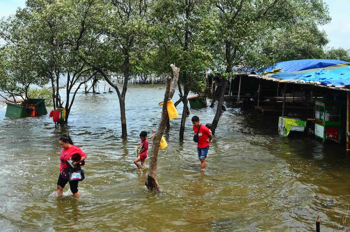
Challenge
Indonesia’s coastal zones face accelerating erosion, habitat loss, and reduced resilience due to sea level rise, stronger storms, and land development.
Solution
Using integrated coastal landscape management, the project combined remote sensing, fieldwork, ecosystem restoration, and stakeholder engagement to strengthen resilience.
Overview
This 1.5-year project, supported by the Asia-Pacific Network for Global Change Research (APN) led by Dewayany Sutrisno (Indonesian Society for Remote Sensing, Indonesia), and in collaboration with her team from multiple countries, tackled climate-related challenges on the northern coast of Central Java, Indonesia.
Coastal communities here face increasingly severe erosion, permanent tidal flooding, and the loss of natural defenses such as mangrove forests. These impacts threaten fisheries, aquaculture, and settlements. The northern coast has experienced years of land subsidence and unplanned coastal development, compounding the effects of climate change and exposing low-lying areas to frequent inundation.
The project introduced a Spatial Planning-Based Ecosystem Adaptation (SPBEA) approach, which integrates scientific mapping, ecosystem restoration, and participatory planning to strengthen climate resilience. This approach also considers socioeconomic factors, ensuring that adaptation measures can support, rather than displace, existing livelihoods.
Developing a science-based frameworktial
The SPBEA model combines geospatial data, ecological assessment, and land use planning to identify priority areas for protection, restoration, or alternative use. The team used satellite imagery, drone surveys, and Geographic Information System (GIS) analysis to map shoreline change, mangrove cover, aquaculture ponds, and vulnerable zones.
This data informed zoning maps that guide where mangroves should be restored, aquaculture adjusted, or infrastructure improved to withstand climate impacts. Historical shoreline data was compared with recent imagery to pinpoint erosion hotspots and measure mangrove loss over time.
Capacity building for young scientists
Recognizing the need for skilled practitioners, the project trained 40 young scientists. Training covered GIS mapping, remote sensing, and coastal vulnerability assessment, along with practical exercises in scenario planning for climate adaptation.
Because of COVID-19 restrictions, a mix of online lectures, interactive mapping sessions, and limited in-person field visits was used. Participants applied the SPBEA approach to the pilot site, producing draft spatial plans, hazard maps, and proposed adaptation measures that could be presented to local government units.
Community engagement
While one focal activity was the workshop in February 2021 in Surodadi Village, Sayung subdistrict, Demak Regency – a community heavily affected by tidal flooding and salinity intrusion – the project’s community engagement was broad. It included a series of village meetings in other parts of Demak and nearby regencies, school outreach sessions to raise awareness among students, and on-site consultations with aquaculture farmers and fishers in multiple villages along the northern coast. These engagements allowed the team to share climate impact information, gather local observations, and jointly explore adaptation options.
In Surodadi, 10 aquaculture farmers participated in the workshop, learning about climate impacts, the role of mangroves in protecting ponds and shorelines, and sustainable pond management. Using project-prepared maps, they contributed local knowledge to refine adaptation plans. Practical activities across sites included planting mangroves along pond banks, piloting an Associated Mangrove Aquaculture (AMA) system, and discussing opportunities for ongoing collaboration to integrate mangrove restoration with livelihood improvement.
Results and recommendations
The project achieved multiple tangible outcomes, including:
- Developing an operational SPBEA framework tailored to Central Java’s coastal conditions.
- Producing detailed geospatial maps of shoreline change, mangrove cover, aquaculture areas, and vulnerable zones.
- Training a regional network of 40 young scientists.
- Conducting numerous community awareness and training events in multiple villages, with active participation from aquaculture farmers, fishers, and local officials.
- Implementing pilot mangrove planting and AMA systems that showed early signs of sediment build-up, shoreline stabilization, and improved pond conditions.
- Strengthening connections between scientific practitioners and local governments to support policy integration.
- Recognized top performers from the training, giving best participants awards to trainees from Myanmar, Chinese Taipei, the Philippines, Indonesia, Trinidad and Tobago, and Malta.
The team observed that restoration sites were beginning to accumulate sediment and support mangrove regrowth, suggesting improved coastal stability. Recommendations, as supported by the project findings, include:
- Embedding the SPBEA approach into local government coastal planning and policy frameworks.
- Formalizing greenbelt zones in spatial plans to protect critical coastal habitats.
- Expanding and refining AMA systems where suitable, based on pilot site performance.
- Continuing and scaling up community-based restoration and monitoring, with ongoing technical support from trained scientists.
- Maintaining partnerships among researchers, communities, and local authorities to sustain momentum and share lessons learned.
Project details
| Project title | Integrated Coastal Landscape Management: An Adaptation Related to Climate Change Impact |
|---|---|
| Year started | 2020 |
| Duration | 1.5 years |
| Countries involved | Chinese Taipei, Indonesia, China, Malaysia, United States of America |
| Funding awarded | US$45,000 |
| Funded by | Asia‑Pacific Network for Global Change Research (APN) |
| Grant DOI | https://doi.org/10.30852/p.4622 |
| Program | Scientific Capacity Development Programme (CAPaBLE) |
| Project reference number | CBA2019-11SY-Sutrisno |
| Project leader | Dewayany Sutrisno (Indonesian Society for Remote Sensing, Indonesia) |
Acknowledgements
This project was supported by the Asia-Pacific Network for Global Change Research (APN) under its Scientific Capacity Development Programme (CAPaBLE). Acknowledgements go to the local government of Demak Regency, community members of Surodadi Village, and all training participants and partner institutions for their contributions.
Related information
- Project Permalink
- Project Final Report
- Sutrisno, D., Rahadiati, A., Bin Hashim, M., Shi, P.T., Qin, R., Helmi, M., … Zhang, L. (2022). Spatial planning-based ecosystem adaptation (SPBEA) as a method to mitigate the impact of climate change: The effectiveness of hybrid training and participatory workshops during a pandemic in Indonesia. APN Science Bulletin, 21(1). doi:10.30852/sb.2022.1772
- APN Facebook
- APN LinkedIn
- APN X
 DISCOVER MORE

