Challenge
Grassland ecosystems in Mongolia face degradation from both climate change and unsustainable grazing, but their relative impacts remain unclear.
Solution
A research team used satellite imagery, field surveys, and expert input to distinguish climate-related and human-driven causes of grassland degradation.
Overview
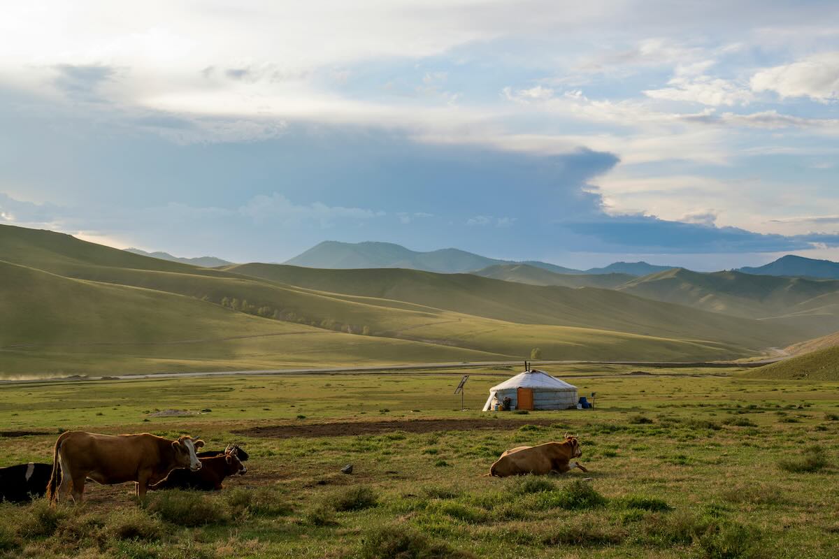
Grasslands cover vast regions of Mongolia and play a critical ecological and economic role, especially for nomadic pastoralist communities. However, these ecosystems are under threat from multiple pressures, including rising temperatures, changing rainfall patterns, and intensifying grazing pressure. To help achieve effective grassland management, researchers must first understand which factors are most responsible for degradation.
This Asia-Pacific Network for Global Change Research (APN)-funded project aimed to disentangle the relative impacts of climate change and human activities on grassland degradation. It was originally led by Inakwu Odeh (The University of Sydney, Australia), who passed away during the course of the project. Suvdantsetseg Balt then took over as the leader.
The project brought together researchers from Australia, China, Mongolia, and Uzbekistan, and combined satellite data with on-the-ground surveys and local knowledge to build a detailed picture of rangeland conditions. The findings revealed environmental patterns and support more targeted and adaptive policy responses for grassland restoration in Mongolia and beyond.
Methodology
The research team used satellite imagery from the Moderate Resolution Imaging Spectroradiometer (MODIS; a NASA instrument that monitors large-scale environmental conditions such as vegetation and surface temperature) and Landsat (which provides higher resolution imagery useful for assessing land cover change) to track vegetation health. MODIS Terra data provided broad regional coverage with a spatial resolution of 186 × 267 meters, while Landsat imagery offered higher resolution at 30 meters. Researchers calculated the Normalized Difference Vegetation Index (NDVI) values from these datasets to assess seasonal and long-term vegetation trends. The analysis covered from 2000 to 2017.
In parallel, field teams conducted surveys across 16 sites in western and central Mongolia. They used a hierarchical sampling method, based on a previous procedure, to gather aboveground biomass data from randomly selected plots. Vegetation coverage and biomass were assessed directly. Teams also recorded local observations and conducted interviews with herders to understand perceived causes of degradation. NDVI values from field plots were cross-compared with satellite sources to validate patterns and refine interpretations.
Key results and findings
- Mongolia, as a whole, did not have sufficient precipitation throughout the summer of 2017, and this affected vegetation coverage.
- Vegetation coverage in the 16 study plots varied considerably by ecological zone, with forest steppe, meadow steppe, and dry steppe sites in central/northerly parts showing more vegetation than dry steppe sites in southern/western parts, and forest steppe generally having higher aboveground dry biomass.
- Field evidence confirmed visible signs of grassland degradation, including dominating undesirable plant species, bare ground, and encroaching sand.
- Herders’ perspectives largely aligned with scientific findings, citing heavy grazing and climate change (reduced/altered precipitation, warming temperatures, desertification) as key drivers. Herders in central provinces primarily cited overstocking, while those in western dry steppe sites attributed it to climate change.
- Satellite readings of plant health showed different patterns across regions, suggesting varied causes of degradation.
Future outlook
The findings underscore the need for differentiated grassland management approaches that reflect the ecological and socio-economic diversity of Mongolia’s regions. Central and western sites exhibit different drivers of degradation, requiring localized responses. Integrating satellite and field-based monitoring should continue as a standard for tracking ecosystem health.
Future work may involve improving temporal frequency of data collection, applying machine learning for degradation detection, and expanding community engagement to co-design rangeland policies. The study supports policy efforts to reform grassland restoration programs and create science-based guidance tailored to regional conditions.
Project details
| Project title | Monitoring Grassland Degradation in North/Central Asia: Deciphering the Impacts of Climate Change and Government Policies at Different Spatial-Temporal Scales Using Remote Sensing and Expert Knowledge |
|---|---|
| Year started | 2015 |
| Duration | 2 years |
| Countries involved | Australia, China, Mongolia, Uzbekistan |
| Funding awarded | US$27,808 |
| Funded by | Asia‑Pacific Network for Global Change Research (APN) |
| Grant DOI | https://doi.org/10.30852/p.4541 |
| Program | Any other activities (AOA) |
| Project reference number | CAF2015-RR14-NMY-Odeh CAF2016-RR14-CMY-Suvdantsetseg (Odeh) |
| Project leader | Inakwu Odeh (The University of Sydney, Australia) |
Acknowledgements
This project was supported by the Asia-Pacific Network for Global Change Research (APN). The research team also acknowledged the local institutions and researchers in Mongolia for conducting extensive fieldwork and contributing expert knowledge. Special appreciation goes to the local herders whose observations added crucial context to scientific data.
Related information
- Balt, S. et al. (2017). Final report: Monitoring grassland degradation in North/Central Asia: Deciphering the impacts of climate change and government policies at different spatial-temporal scales using remote sensing and expert knowledge. Asia-Pacific Network for Global Change Research. https://www.apn-gcr.org/publication/project-final-report-caf2015-rr14-nmy-odeh/
- Wang, Q., Zhang, Q., Liu, Y., Tong, L., Zhang, Y., Li, X., & Li, J. (2019). Characterizing the spatial distribution of typical natural disaster vulnerability in China from 2010 to 2017. Natural Hazards, 100(1), 3–15. https://doi.org/10.1007/s11069-019-03656-7
- Zhang, C., Zhang, Y., Wang, Z., Li, J., & Odeh, I. (2020). Monitoring phenology in the temperate grasslands of China from 1982 to 2015 and its relation to net primary productivity. Sustainability, 12(1), 12. https://doi.org/10.3390/su12010012
- APN Facebook
- APN LinkedIn
- APN X